

DAYTON — UPDATE @ 11:58 P.M.
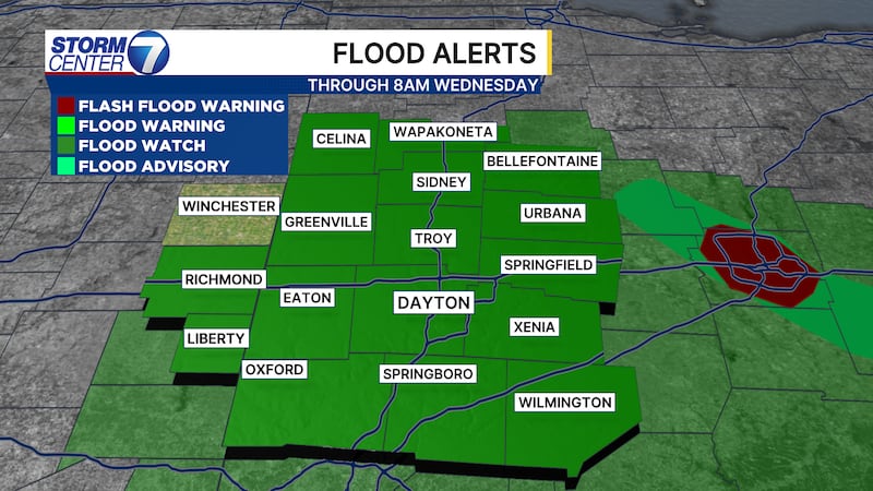
A Flash Flood Warning has been issued for Auglaize, Logan, and Shelby counties until 1:30 a.m. on Tuesday.
A Severe Thunderstorm Watch has been issued for Clark, Greene, Montgomery, and Preble counties until 2 a.m. on Tuesday.
A Flood Watch is in effect for the entire region until Wednesday morning.
-INITIAL STORY-
Numerous storms Tuesday could produce damaging straight-line winds, small hail, or a brief tornado.
This is Storm Center 7 Meteorologist Ryan Marando.
The entire Miami Valley is under a three out of five, enhanced, risk for severe weather Tuesday.
The primary concern will be for storms producing damaging straight-line winds that could knock down trees or powerlines.
Some storms could contain small hail or spin up a brief tornado.

[DOWNLOAD: Free Storm Center 7 Weather app for alerts as news breaks]
Two rounds of storms may be possible.
This type of storm system is tricky, as our computer models have a tough time producing what they could do.
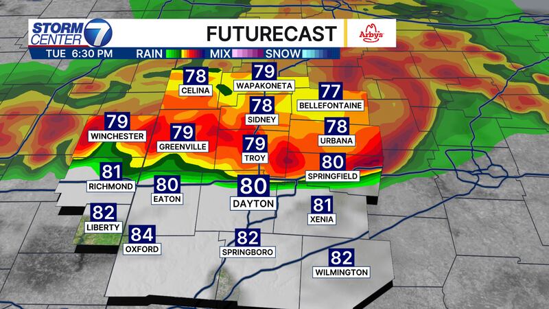
A first round of storms may be possible early in the morning between 7 and 10 a.m., although the more likely timing will be for storms after 4 p.m.
If these storms shift even just 50 miles, that could mean the difference between seeing nothing or getting a severe storm.
Stay weather aware!
[WATCH Storm Center 7 Weather on the following devices]
In addition, there is a lot of moisture in the atmosphere.
These storms could dump flooding rains.
A flood watch has been posted until Wednesday morning.
Poor drainage areas or roads may flood with these heavy downpours.
©2026 Cox Media Group