

DAYTON — UPDATE @ 2:41 p.m.:
A Severe Thunderstorm Watch has been issued for Randolph County, Indiana until 9 p.m.
INITIAL REPORT:
This is a tricky forecast with lots of uncertainties. Here’s what we know. This is Storm Center 7 Meteorologist Ryan Marando.
Here’s why the confidence on this forecast remains low:

[DOWNLOAD: Free Storm Center 7 Weather app for alerts as news breaks]
I am leaning towards storms happening during the evening hours after 4 p.m. but before midnight. Storms could continue during the overnight hours.

This is a different computer model at the time. There is the possibility that no one sees storms and they miss us entirely.

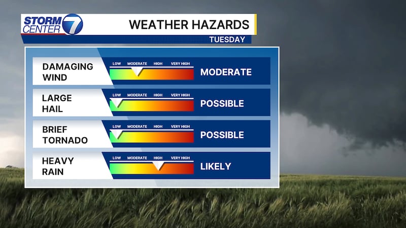
If storms do fire up, they could come with heavy downpours, frequent lightning, or even produce damaging straight-line winds. Areas north and west of Dayton are now under a level three of five, enhanced, risk for severe storms.
[WATCH Storm Center 7 Weather on the following devices]
All severe weather hazards are possible, but damaging straight-line winds are our greatest concern. Large hail and tornadoes are low risk.
©2026 Cox Media Group