

DAYTON — An area of low pressure is setting up right over the border of the US and Canada.
Attached to it, a cold front that will attempt to move through the Miami Valley.
The front will stall over the Valley and increase rain and storm chances through the weekend.
[DOWNLOAD: Free Storm Center 7 Weather app for alerts as news breaks]
Something to note: the rain chances are scattered and will not impact everyone.
In fact, there will be more dry time than scattered downpours.
No severe weather is expected, but that doesn’t mean strong storms can’t be ruled out.
Strong winds, heavy rains, and frequent lightning would be the greatest threats.
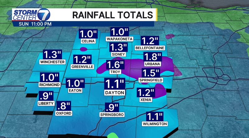
Rainfall totals will amount to roughly 1 to 2 inches through Sunday, but isolated higher amounts are possible under heavier downpours.
[WATCH Storm Center 7 Weather on the following devices]
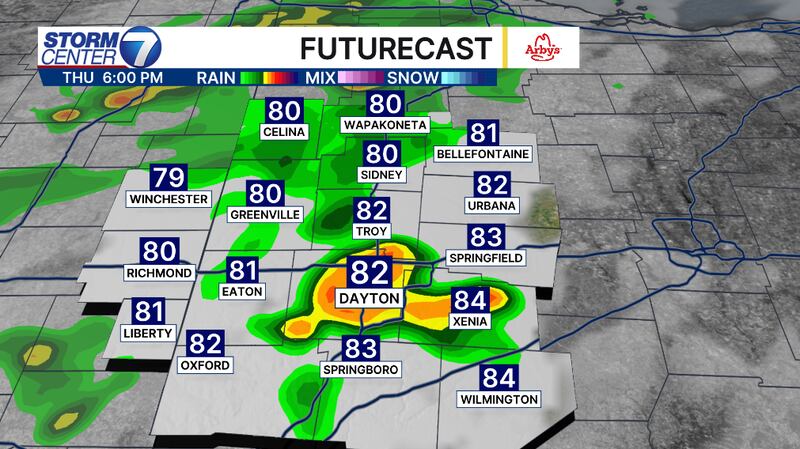
Thursday evening will be a good chance for storms to move in after 5 PM.
This will linger through Friday early morning.
Friday afternoon and evening are our greatest chance for rain and a few storms.
Saturday and Sunday, our rain chances will become more isolated. In fact, most will stay dry on Sunday.
©2026 Cox Media Group